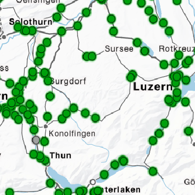
The following examples show what can result from the opening of the customer information data of ÖV Schweiz.
We are always interested in what is done with our data. Contact us, then we can show your examples here.
105
showcases found

Github-Repository openTdataCH
The Specialist Office Open Data is gradually making small code fragments and tools available on Github.

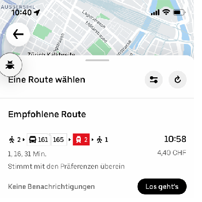
Swiss Transit App
All trains, trams, buses, ships and cable cars in your pocket.
Timetable search
Timetable search including walking routes to the stops, tickets, departure tables, map
Data/APIs used:
- Timetable HRDF
- GTFS Realtime
- Incident Management Public Transport Switzerland (SIRI-SX / VDV736)
- Openstreetmap (for footpath route planners to/from the stops)

vbot.ch
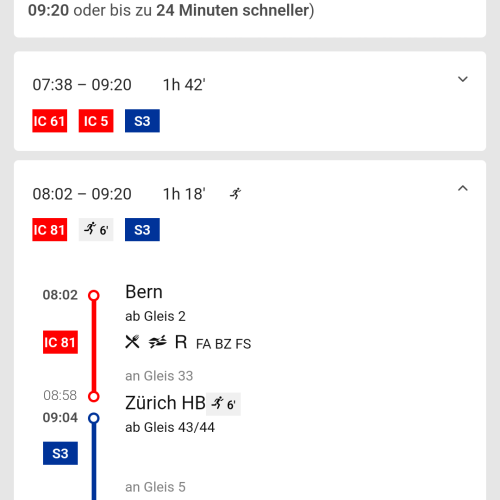
The fastest timetable.
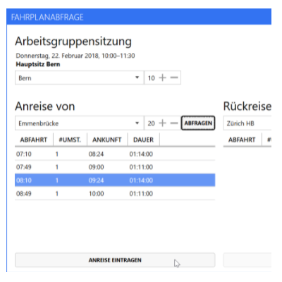
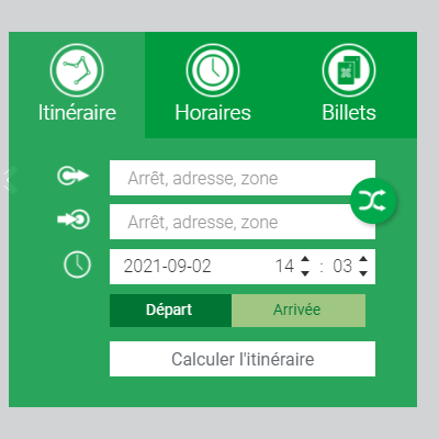
Viadi Routing Service
Query public transport connections throughout Switzerland using a web-based REST API.
Time for Coffee
Relax and don’t wait at the station for the next bus, tram, boat or cable car.

Rome2rio
Rome2rio is a comprehensive global travel planner with over 10 million monthly visitors.
Welcomescreen
For the “Welcomescreen” of our agency building, we have aggregated data from various sources and make it available to our visitors on a screen in the entrance hall.
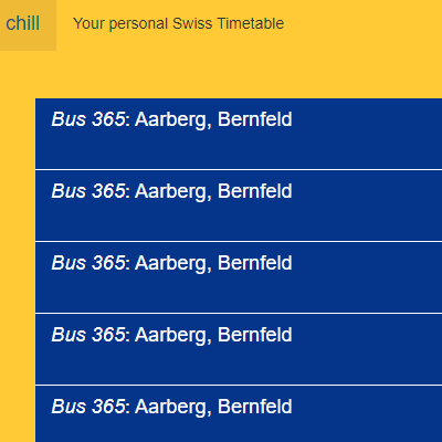
chill
Your personal Swiss departure indicator.
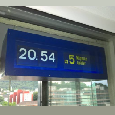
Personal departure indicator from drop leaf modules
The developer built his very own personal departure indicator from discarded SBB drop leaf modules and placed it on his balcony.

Own arrival indicator
Own arrival indicator to facilitate the loading / unloading of trains.
“Berliner-Linien”
The “Berliner-Linien” application is an experimental website. It shows public transport networks generated from GTFS files, offering the user a high degree of interactivity.
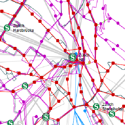
TRAVIC
Transit Visualization Client
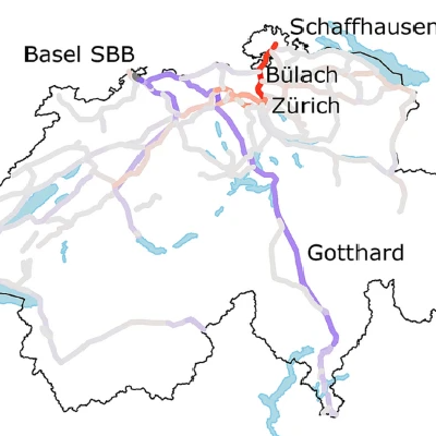
Swiss Railways Network
This map is an animation based on the official timetables of the Swiss Federal Railways (SBB) network.
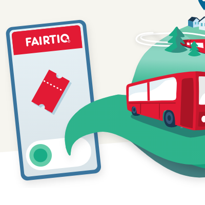
FAIRTIQ
Fairtiq uses the GTFS timetable data from opentransportdata.swiss to enrich the recognised means of transport journeys with the timetable data.
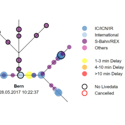
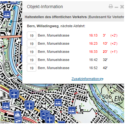
Arrival monitoring at Bern station
The visualisation of the arrival data consists of two parts: On the left or at the top, the xy-diagram with the arriving trains travelling along the x-axis into the station. If a delay is forecast, this is indicated by means of a rise up the y-axis.
Delays at the biggest stations
The different graphs show the corresponding distributions. In combination with filter functions, insights can be gained from the visualisation.
SBB Delay visualisation
Would you like to know how many trains arrive late at your station? Simply search for the name of your station in the search bar. A type-ahead function helps you find the station you are looking for more quickly.

Visualisation on OpenStreetMap
Visualisations of public transport data on the Open Street Map. This app was developed as part of a CAS at the University of Bern.
Real-time departure indicator on the federal map viewer
On the federal map viewer map.geo.admin.ch, the real-time departure displays for the stops geobase dataset were implemented.

Stations 4
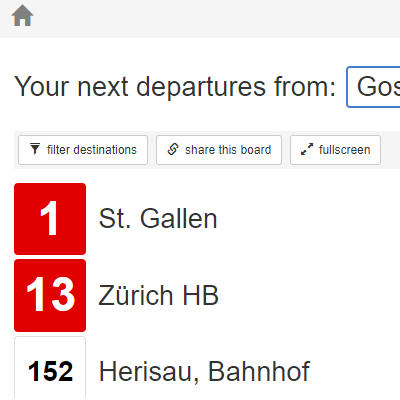
Timetable change, snow, delays? Live departures on public transport in Switzerland with the new Stations app.
Switzerland as a commuter country
Here, GA and Half-Fare travelcards sell best.
Wemlin
Reach your destination quickly with Wemlin and the timetables of OSTWIND, BLT, Liechtenstein, TPF and ZVV mobil.
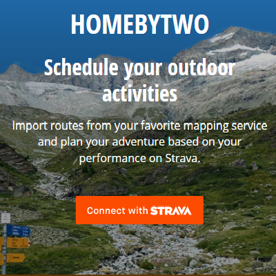
Home by two
Plan your rides to the minute based on past performance on Strava. During the activity, Home by Two tells you if you are on schedule and estimates the return time accordingly. If you change your plans, you can easily find the best connection home.
Stations App
Stations – the perfect app for commuters! Stations is for all regular public transport users in Switzerland who know “their” stations and connections and want to be informed easily and quickly about the next departure times, delays and any track changes.
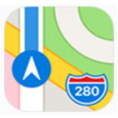
Apple Maps
Maps. You’ll go down better with that.
In the public transport view, you can see information on metros, buses, trains and ferries, specifically adapted to each city for which it is available. Plan an exact route, keep an eye on timetables, get detailed directions or ask Siri where to go. You can also add a specific public transport line to your favourites and receive up-to-date information or reminders. The list of supported locations is constantly growing.
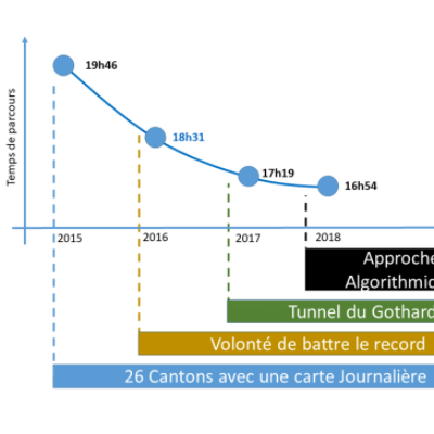
Swiss Train Challenge
26 cantons as quickly as possible by public transport.
In order to break the current record of 17 hours and 19 minutes, the timetable was optimised using an algorithm based on SBB’s opendata. RTS reported on this in its programme “19h30”. In the meantime, the algorithm was also described in a publication of the geomatic journal XYZ.

On Time Switzerland
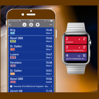
This app is a must-have for all public transport users with an Apple Watch.
Quickly and easily check departure times on your Apple Watch or simply find the next stop in your area. Works for all public transport: stations + departures nearby, connection details, ‘Home’, favourites, map to station, notifications, rail traffic information (RSS).
Swiss Public Transport
This app is your personal public transport assistant for Switzerland!
Whether you use it for your daily commute or for a hike in the Alps, this application offers you live connections throughout Switzerland.
TakeMeHome.ch
TakeMeHome.ch gets you to your destination faster by public transport in Switzerland.
After you have entered your 4 main destinations in the “Settings”, you can easily display the next “fastest” connections from a nearby stop to your destination.
QuickÖV
Reference work for public transport in Switzerland.
Searching for the next departure time of frequently used public transport connections can be problematic if the app used is too complicated or starts too slowly. QuickÖV solves this problem by allowing the user to define preferred connections and display them immediately after starting.
Trnsport.ch
Connection via web address
Fill in the form to search for a connection by public transport. Share the found connection by copying the web address into any message.
Public transport timetable as workflow
You want to know quickly when the next train leaves or whether your planned connection is delayed?
With this workflow for the productivity app Alfred for Mac OS X, you are only a shortcut away from this information at any time.
OutlookSwissPTTimetable
OutlookSwissPTTimable: Timetable add-in for public transport in Switzerland for Microsoft Outlook

GeoNames.org
GeoNames.org is a global geographic database available under a cc-by licence. The data often come from national data sources (such as Swisstopo in Switzerland). In addition, a wiki edit interface is available that allows users to make simple changes.

Marey-like timetable Geneva-Lausanne
Train services between Lausanne-Genève on weekdays. The points represent the 80% delay quantile on arrival at the station.

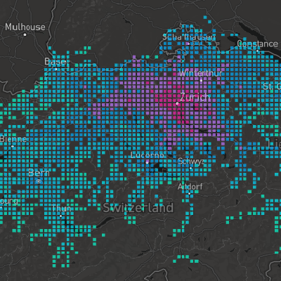
Mapping swiss trains delays over one day
On a few selected days, you can scroll through time and see how trains are delayed in Switzerland.
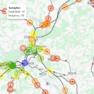
Treffpunktsucher
The app can be used to find an optimal public transport meeting point for people from different corners of Switzerland. The public transport journey times were prepared on the basis of the timetable data.

Chunder
A tool for all public transport users.

Sojo: Intelligent mobility
Easy planning of your journey by train, tram and bus (bike and scooter coming soon). Automatic warnings about delays on your frequently used connections.
(Google and Apple App available)

Next ZVB departure times per line
Display of the next departure times per line. (Example Baar, railway station).
Traffic counter
Where are there currently traffic jams throughout Switzerland?
More transparency at SBB
Now punctuality of trains is reported more often.

Internal evaluations at RHB
The data is used for an internal evaluation.
In the past, passenger punctuality was evaluated via SAS. Now the data of the platform is used for this purpose.
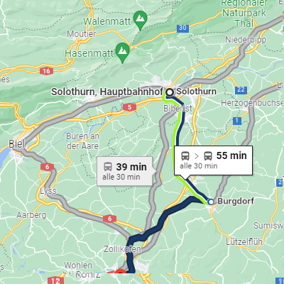
Journey Planner of the MBC
MBC uses the OJP as a journey planner.

Traffic Corona Monitoring
Comparison of traffic figures at important measurement locations/payment points on the national road network.

Calculation of community shares
To determine the number of scheduled departures, AöV accesses information from the Mobility Switzerland open data platform. Specifically, the timetable data in GTFS format is used.

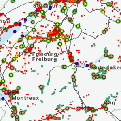
Network graphic Switzerland
Network graphic Switzerland
Research based on Open transport data at ETH Zurich
The data has been used in many studies at ETH Zurich, Chair of Transport Systems; we are happy to share the results of our analysis of the impact of the Rastatt 2017 disruption on the Swiss rail system.
yumuv
All means of transport in one subscription. With yumuv, all the possibilities of urban mobility are easily open to you. This way, one app becomes your key to the whole city.
Study on the traffic behaviour of the population
A routing tool was developed with the timetable data, which was used in telephone interviews with more than 50,000 people in 2010, 2015 and 2021. The final product is the Microcensus Mobility and Transport (MZMV), the largest survey of the population’s transport behaviour conducted at the national level. Routing with the timetable data improves the data quality in terms of distances travelled and enables evaluations of the collected data according to the categories of long-distance, regional and local transport.
Traincation
Here comes Traincation! Since you’ll be spending your 2020 summer holidays in Switzerland, why not take the train? Traincation helps you calculate the best journey between the places you want to visit.

Citymapper
Instantly compare your travel options in real time for all urban mobility.
Data/APIs used:
Public transport app tried out
The public transport survival app for abroad is now also available for journeys and trips in Switzerland. PCtipp has tried them out.
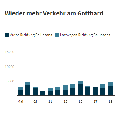
Counting point 150 (Gotthard North)
Number of cars and trucks passing through the Gotthard tunnel heading south.
QMS RPV
The FOT operates a quality measurement system (QMS) in regional passenger transport (RPV). Around 60 part-time test customers from an external company measure punctuality, cleanliness, tidiness, the integrity of vehicles and stops, and the quality of passenger information on behalf of the FOT.
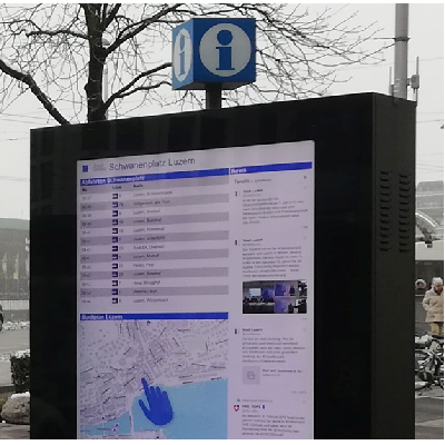
City maps with touch screen in Lucerne
Lucerne has 7 digital city maps with touch screens. These screens are also used as info screens for the population and as one content the departure times of the next stop are displayed. Realised with html/javascript and their API, updating every minute.
Offline public transport
Offline timetable for the whole of Switzerland.

Google Maps is increasingly becoming an indispensable travel tool
The digital map service has been in existence for 15 years and has constantly evolved over time. Today, the tool is much more than just a map.
Public transport quality classes
Display of public transport quality classes on map.geo.admin.ch.
Interactive map
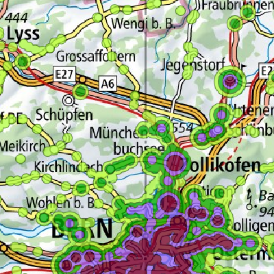
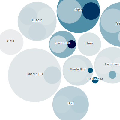
The big route analysis: This is how punctual the trains were last year in Aargau.
SBB makes all data on arrival and departure times for Swiss rail traffic available to the public. We have analysed the most important connections in Aargau over the last year.

Accessibility quality of a location
The timetable data is used to assess the accessibility quality of a location. Two key figures are calculated: travel times and accessibility potential. The aim of the application is to help people who are looking for a home to find the right community.
Website Zugerberg Railway
In the tab “Next departure” a ZVB stop can be selected/typed in. For example, “Metalli/train station”. On the ZBB (Zugerbergbahn), the data is loaded into the “My mountain railway journey” tab.
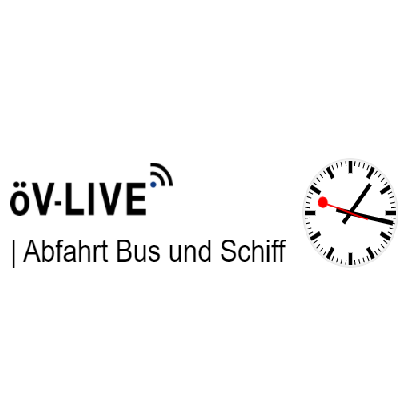
öV-Live
The GTFS data of the SGV are used as VDV real-time data substitute.
Network map passenger transport
Real time network map
iTPG
Timetable App from OG app’s

L’indice ferroviaire TTC
L’indice ferroviaire TTC was developed by Radio Television Suisse and gives a punctuality measurement for long-distance and regional lines.
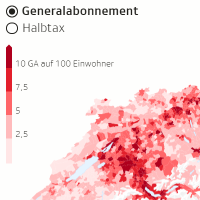
GA and Half-Fare travelcard validity
Overview of all mountain railways with information on GA and Half-Fare validity.
Correspondence lines at stops
Show correspondence lines at stops, including next departures in minutes.
Tempusfugit
It allows you to view the journey time to all stops in Switzerland from the main cities (isochronous map). Quick and easy to use, the idea is to help people choose a destination for an excursion, a place of work or a place of residence according to the amount of time to be spent on public transport.
The tool is under development, but this is the first stable version.

Digital Signage CMS
screenfoodnet.com offers a digital signage CMS, in which a module for timetables is also offered. This means that customers who use the CMS to manage their advertising screens can also display up-to-date timetable information. Similar modules are already in use for weather, news and sports.
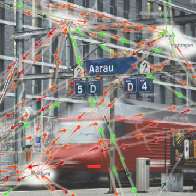
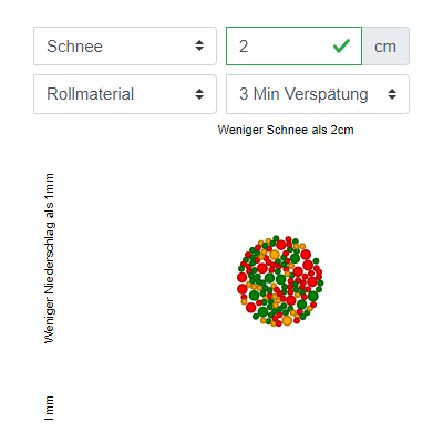
SBB junction stations under the microscope
Switzerland is a public transport country and has been at the centre of Europe’s north-south axis for centuries. Using SBB delay data, the problem of so-called junction stations that have a direct north-south connection will be examined.
Punctuality in train traffic
Find out which types of trains get you to your destination on time in the morning commuter traffic – have fun!
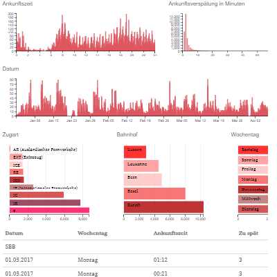
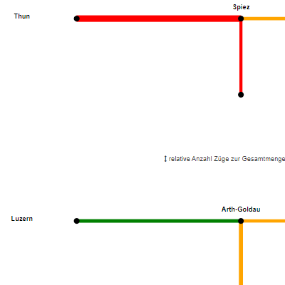
Punctuality of IC connections at Bern station
The visualisation offers several possibilities to select the points. You can sort by line (route) or by rolling stock. Subsequently, the weather influences, the delay and the time series can be defined.

ECOSPEED Region
The tool can be used to create a territorial energy and CO2 balance. The tool is used by municipalities and the cantons.
Minimum travel times on public transport in Switzerland
On an interactive map, the shortest travel times from a selected stop to a selection of stops are shown in different colours. Only stops that can be reached in a definable maximum desired travel time are displayed.
OJP-Showcase Repository
This repository contains tools and applications created to import, analyse and visualise opentransportdata.swiss datasets.
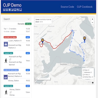
OJP Demo App
Web-based application that demonstrates and implements the capabilities of the Open Journey Planner (OJP) APIs to support distributed journey planning according to the technical specifications of the European Committee for Standardization (CEN). The source code is published as open source software and is available under the OpenTdataCH Github account. https://github.com/openTdataCH/ojp-demo-app-src
Raily – Departure tables for Swiss public transport as a widget on the iPhone
Raily – Departure tables for Swiss public transport as a widget on the iPhone. For the first time, there is a real widget for the home screen that shows departures in the vicinity. The app is based on the open data interface to Swiss public transport and therefore interesting for you.

Alexa Skill – Swiss public transport
With this skill, Alexa can query timetables of the SBB and other public transport in Switzerland.
Journeys of a day on the map in fast motion
Animation I created from the data of the Open Data Platform Mobility Switzerland. It shows the journeys of a day on the map in fast motion.
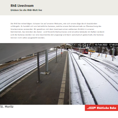
Digital Signage RhB Livestream
With our developed programme, timetable data as well as the effective times of the trains are retrieved via the Opentransportdata. Based on this data, the times are compared with the configured cameras and possible events are determined.
The moving trains can be viewed directly via the RhB Livestream as well as via digital signage displays at various locations.

MOTIS Project
Intermodal travel information Real-time routing with trains, buses, trams, planes, bike sharing, carpooling and much more!
Data/APIs used:

TRAVYS
Timetable with real-time information from the Open Journey Planner.
UBER
Uber users in Zurich can now access the “Public transport” function in the app. This means that additional options and information are displayed for each new journey request.
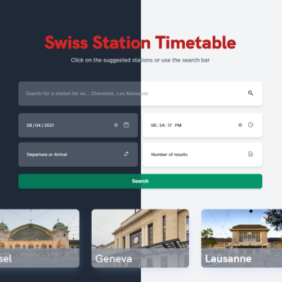
Open Source Web App – Swiss Station Timetable
Custom API that retrieves data from OJPStopEventRequest and converts XML to JSON
For the frontend, I use a custom API and show the departure and arrival list of a selected station (bus, train, tram, metro, boat, etc.).
http://Open Source Web App – Swiss Station Timetable
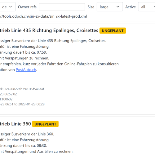
SIRI-SX IFrame
With the SIRI-SX IFrame, transport companies and business organisations can integrate disruption information from all over Switzerland on their website. Users can filter by language, operator, text length and status of the faults. In this way, only the disturbance information intended by the users is displayed.
See the Github repo for more details.
Data / APIs used:
Building a VBZ Display Clone
How to build your own desk/wall version of a VBZ LED display for tram/bus departures, including the analysis and detailed guide on how to implement such a project.
Foxtrail
Foxtrail uses public transport on numerous trails. For optimal customer guidance, departure data from the Mobility Switzerland open data platform is used for this purpose. In this way, customers are optimally guided early on before the stop so that unnecessarily long waiting times are eliminated.
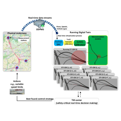
Digital Twin – Geneva Motorway
The model for the Digital Twin – Geneva Motorway (DT-GM) uses the data from the traffic counters (road traffic). The model is available on the SUMO (Simulation of Urban MObility) website. For further details see Github repository.
Data/API used: Traffic counters (road traffic) – real time
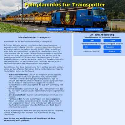
Timetable info for trainspotters
On this website, various raw timetable data from so-called GTFS feeds (Google Transport Feed Specification) are processed and displayed.
Data used: Timetable (GTFS)
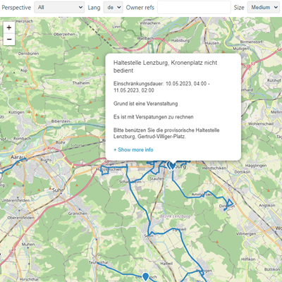
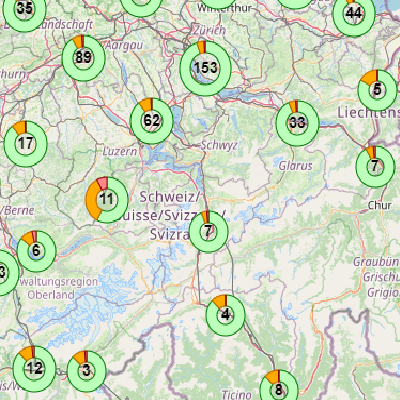
Overview map of event reports in Switzerland
This application is currently not available. The repair is planned for the period May-July 2024.
The visual representation of all event and disruption messages in Switzerland was created by students from the Bern University of Applied Sciences in collaboration with the SBB NDx team. The map displays all current event and fault messages in Switzerland. It obtains its information directly via the Open Data platform. Users can filter by perspectives, language and business organisations. It is also possible to transfer the filters to a new map and integrate it into your own website.
Data used: API for event information öV Schweiz (SIRI-SX / VDV 736)
Further information about the data source and incident information: Cookbook Event Information öV Schweiz (SIRI-SX / VDV736)
Github repository: https://github.com/openTdataCH/siri-sx-map
TransitoCity
TransitoCitymakes it easier to use public transport in Turin, Rome, Milan and Zurich. Users can see in real time (if available) the nearest buses and available routes in their vicinity.
Data/APIs used:
Train O’Clock Switzerland
Train O’Clock helps commuters find their train schedules instantly. The website offers information about timetables, railway stations as well as train lines.
Data/APIs used:
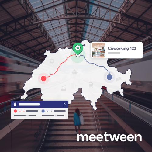
Meetween
With ‘Meetween’ you can find optimal meeting points with optimised travel time for all parties in no time. Enter all departure points and see which public transport station is the quickest for everyone to reach for your next meeting.
Viadi App
Viadi – the personal and fast timetable. Viadi provides you with the public transport information you need, when you need it. For all those who want to go Pro with public transport.
Data/APIs used:

Viadi Mobility Services
A routing service for a wide range of data formats and interfaces: classic public transport queries can be easily supplemented with intermodal ones. The simple system is easy to configure and leaves room for individual extensions.
Tram Tracker
It is not always easy to know where the tram you are waiting for is.
The following script maps all moving trams within the VBZ network: VerkehrsbetriebeZuerich/ tram-locator
Trams TramTracker – Map locations are based on static timetables and dynamic timetable updates (live delays) retrieved via opentransportdata.swiss.
A CSV file with all currently running trams and the associated location, destination and delay information is written as the output file.
Data/APIs used:

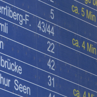
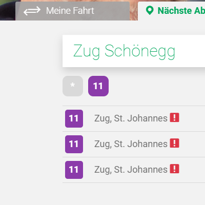
Tramli – Your stop for at home
Tramli shows you the departure times at your next public transport stop in real time. Never miss your tram, bus or train again, because with Tramli you can choose from all stops on the Swiss public transport network.
Data/APIs used:
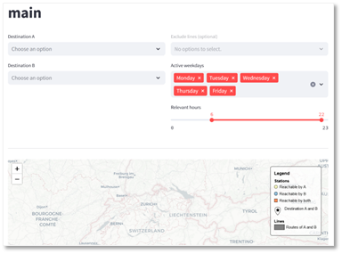
commute-city-triangulation
With commute-city-triangulation, you can always find a location on the Swiss rail network from which you can reach several destinations directly:
Data/APIs used:
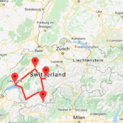
Public transport to Swiss mountains
With “Public transport to Swiss Mountains” the use of public transportation for mountain sports in Switzerland will be promoted. Its primary objective is to provide information about the most efficient routes via public transportation to reach various altitudes in Switzerland. This project is designed to assist users in discovering new destinations for snow sports or simply finding an enjoyable spots with breathtaking views and fresh air atop Switzerland mountains, all while promoting environmental preservation.
Gitlab-Repos:
- https://gitlab.com/public-transport-to-swiss-mountains/destination-finder
- https://gitlab.com/public-transport-to-swiss-mountains/travel-planner
Datasets / APIs:
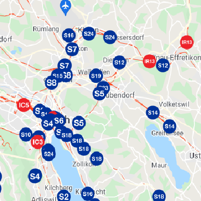
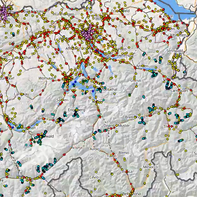
Train Delay Visualizer
The Train Delay Visualizer is used to visualise the delays of all train connections in Switzerland on a map based on actual data and the service station (today).
OpenSource Quellcode (GitHub):
Data sets / APIs:

HERE Location Services
HERE Transit and Intermodal APIs are the part of HERE Location Services, which is an established technology supplier for several industries, including the Public Transit, Automotive, Transport & Logistics, E-Commerce Business and others. HERE Transit is committed to supporting a ‘Greener Earth’ by promoting the use of public transit combined with shared or private bike, car and pedestrian options. The near global coverage of HERE Transit API includes real-time delays, alerts, and more to ensure seamless travel from doorstep to destination. It also supports barrier-free routing and will soon introduce routing with fare information. The steadily growing global coverage can be explored via free API transactions, with a limit up to 5000 monthly transactions for Transit API and up to 2500 monthly transactions for Intermodal API. Please refer to our one-pager document for more details.
Data/APIs used:
Current operating situation & disruptions on the BLS route network
On this website, BLS informs its passengers about the current operating situation of its rail, bus, boat and car transport lines.
Data/APIs used:
- Siri SX
- Event messages from DDIP